
Modernize Property Management with ArcGIS Technology
Transform land records and parcel management with enterprise-grade GIS solutions. From 3D property visualization to comprehensive data management, we deliver next-generation digital mapping for municipalities and governments.
Specialized ArcGIS Capabilities
Comprehensive solutions for modern land records and property management
NYC Property Information Portal (PIP)
Revolutionizing urban property management with 3D ArcGIS technology
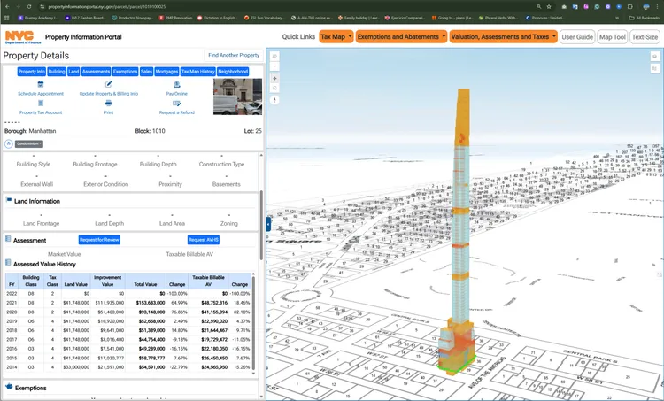
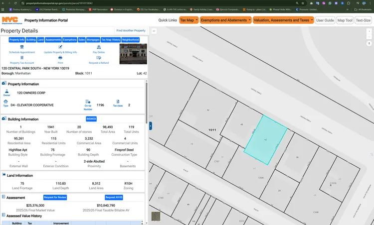
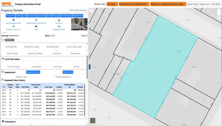
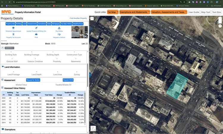
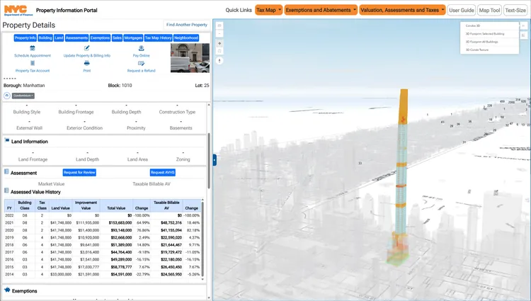
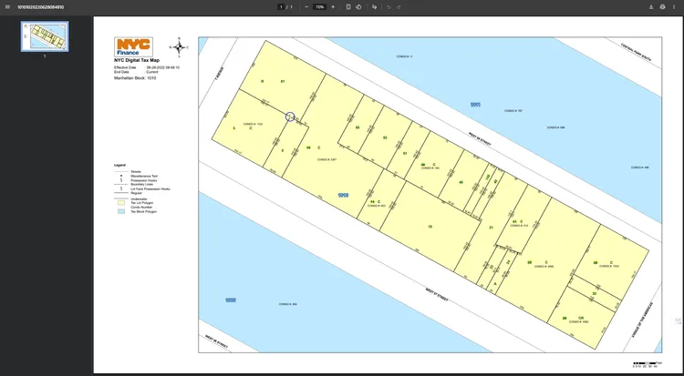
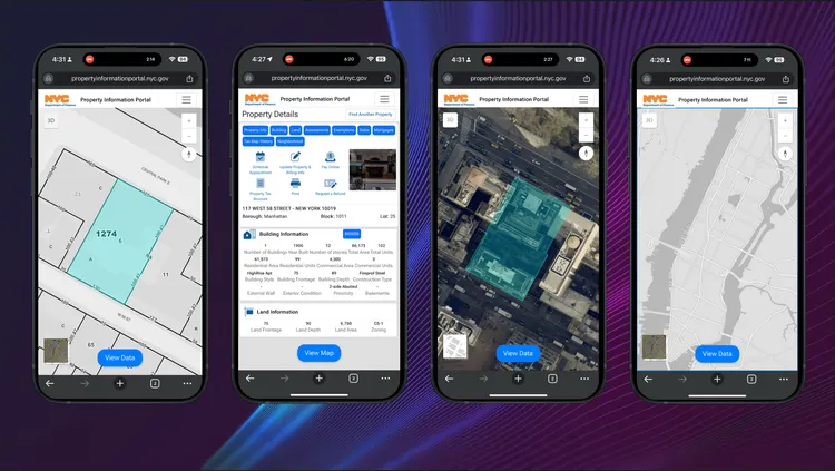
Property Information Portal
The Property Information Portal is a one-stop shop for taxpayers to access property cards, manipulate data by selecting geographic boundaries, and view depictions of condominium, air rights, and subterranean lots.
Key Achievements:
- One-stop portal for taxpayers to access property cards
- Data manipulation through geographic boundary selection
- 3D visualization of condominiums, air rights, and subterranean lots
- Next-generation digital tax mapping implementation
- NYC: One of few cities worldwide with complete 3D component
Specialized ArcGIS Services
Comprehensive solutions for local governments and land records management
ArcGIS Application Development
Complete customization of the Esri ArcGIS platform to meet specific business requirements and efficient implementation.
Key Highlights:
- ●Platform customization
- ●Subsystem integration
- ●Cloud-ready solutions
Outcome: Efficient implementation aligned with business requirements.
Parcel & Records Management
Comprehensive support in development, data migration, and subsystem integration to improve land information management.
Key Highlights:
- ●Data migration
- ●Optimized workflows
- ●Data integrity
Outcome: Improved land information management and data integrity.
Spatial Analysis & Cartography
Specialized services in digitization, spatial analysis, spatial database design, and presentation mapping.
Key Highlights:
- ●Cartographic modeling
- ●Data analysis
- ●Database design
Outcome: Enhanced spatial insights and professional cartographic outputs.
Data Integration & Transformation
Focus on data transformation, harmonization, and integration to ensure compatibility and interoperability.
Key Highlights:
- ●Data transformation
- ●Harmonization
- ●Interoperability
Outcome: Seamless data integration across systems and platforms.
ArcGIS Consulting & Expert Staffing
Strategic consulting and on-demand GIS specialists to design, build, and operate your ArcGIS Enterprise or Online environment—aligned with your business, compliance, and operational goals.
Key Highlights:
- ●Platform governance
- ●Performance & security optimization
- ●Specialized teams
Outcome: Faster delivery, reduced technical risk, and measurable ROI.
Enterprise Solution Customization
Tailored ArcGIS Enterprise solutions built on proven deployment patterns, integrating data, apps, and services across departments.
Key Highlights:
- ●Multi-environment architectures
- ●Enterprise Geodatabases (PostGIS, SQL, Oracle)
- ●Utility Network & field workflows
Outcome: Scalable, secure, and maintainable GIS solutions that evolve with your business.
System Migration & Modernization
Modernize legacy GIS systems without operational disruption. We plan and execute migrations to ArcGIS Enterprise/Online with full QA/QC and rollback readiness.
Key Highlights:
- ●EGDB consolidation
- ●Schema refactors
- ●Security and compliance upgrades
Outcome: Predictable go-lives, higher system reliability, and improved user experience.
Cloud-Native ArcGIS Deployments (IaC + CI/CD)
Deploy ArcGIS on AWS, Azure, or GCP using Infrastructure as Code and modern DevOps pipelines for speed, security, and scalability.
Key Highlights:
- ●Terraform / GitHub Actions / Kubernetes
- ●Blue-green releases & observability
- ●Cost & security guardrails
Outcome: Reproducible environments, faster releases, and lower total cost of ownership.
Architecture & Documentation Pack
Comprehensive, audit-ready documentation that connects business strategy with technical execution.
Key Highlights:
- ●Architecture Decision Records (ADR)
- ●C4 & network diagrams
- ●Data dictionaries & service catalogs
Outcome: Unified understanding, easier audits, and faster onboarding.
Ready to Modernize Your Parcel Management?
Discover how our ArcGIS solutions can transform land records management in your organization. Our team of experts is ready to help you navigate your digital transformation.